Saturday, 20 March 2021

East Lothian - Camp stove picnic

One thing I've missed over the recent lockdown is getting away camping. In particular, I miss the fun of cooking at the tent in the evening and the reassuring roar of the camp stove as it sparks into life. But I had an idea recently to at least recreate one of those elements by cooking a hot lunch on the camp stove while out for exercise. And the perfect place for this was the Pencaitland Railway Trail. It's one of my most used local cycle routes and I've really appreciated it over the last year of the pandemic. So my friend Graham and I packed up our bicycles and headed out there on a grey, cold day that felt neither winter nor spring. 

We soon cycled by what we now call "lockdown bench" - a place where we used to sit and have a flask of coffee when we were out cycling in the first lockdown. A little further on though, we pulled into our favourite spot where a couple of picnic benches are set on grass beside allotments. It's a lovely place, tucked away from the world and really peaceful. There are flower borders which today were dotted with snowdrops. In summer they are full with wildflowers which buzz with bees. There is woodland all around so the air is always filled with birdsong. We wrapped up in blankets, set up our camp kitchen and got cooking. Our hot lunch today was pan fried salmon and asparagus served with our favourite Idahoan instant mash potatoes. This was followed by Gu gluten free cheesecakes washed down with coffee. The cheesecakes were really handy for transporting by bicycle and miraculously arrived in one piece. 

Quite a feast! The only downside, having eaten so much, was cycling home again. 

Friday, 12 March 2021

Scald Law - Eleven below

There's an old saying, in outdoor circles at least, that in summer Scotland has hills but in winter, it has mountains. Although our hills are not high, the northerly position exposes them to a harsh climate in winter which makes them much more challenging than you might guess from their height. It might be a stretch to apply this logic to my lowly local hills, the Pentlands, which only reach 500 metres or so. However, the thought was in my mind recently as pictures appeared on social media of a significant avalanche on Turnhouse Hill, barely a bump in the Pentlands. Then a walk up Scald Law really drove home the message as we ascended its snow-covered slopes into testing winter conditions. 

We'd walked in from its south side, just as the sun was clearing the morning horizon. It cast an alpenglow over Scald Law above which stopped us in our tracks as we gazed up. Like all tricks of the light, it was an ephemeral moment and we soon continued along the main path. It was well trampled in the snow and took us through stands of gorse and rough pasture to the lower slopes of the hill. 

Where we met a drystone wall, we left the path, strapped on our snowshoes and headed across country. We made progress by stitching together the lines of deeper snow which was soft powder in some places but wonderfully hard-packed in others, perfect for the snowshoes. 

As we climbed, the flush of colour from the dawn sun drained from the land and a monochrome, winter world stretched out below us. When we gained more height, the character of the snow changed and we marvelled at the beautiful sastrugi, the wave-like patterns in the snow created by the wind. Of course, it was a forewarning of the conditions up ahead. 

The final section to the top of Scald Law was steep. It's steep in summer when it's grass but in winter, under snow, it's really steep. We were grateful that the snowshoes had crampon spikes to bite into the hard snow but I think we were probably stretching the limit of them. However, no sooner had we pulled onto the top than we didn't need them as it was mostly scoured of snow by the wind that blasted through. 

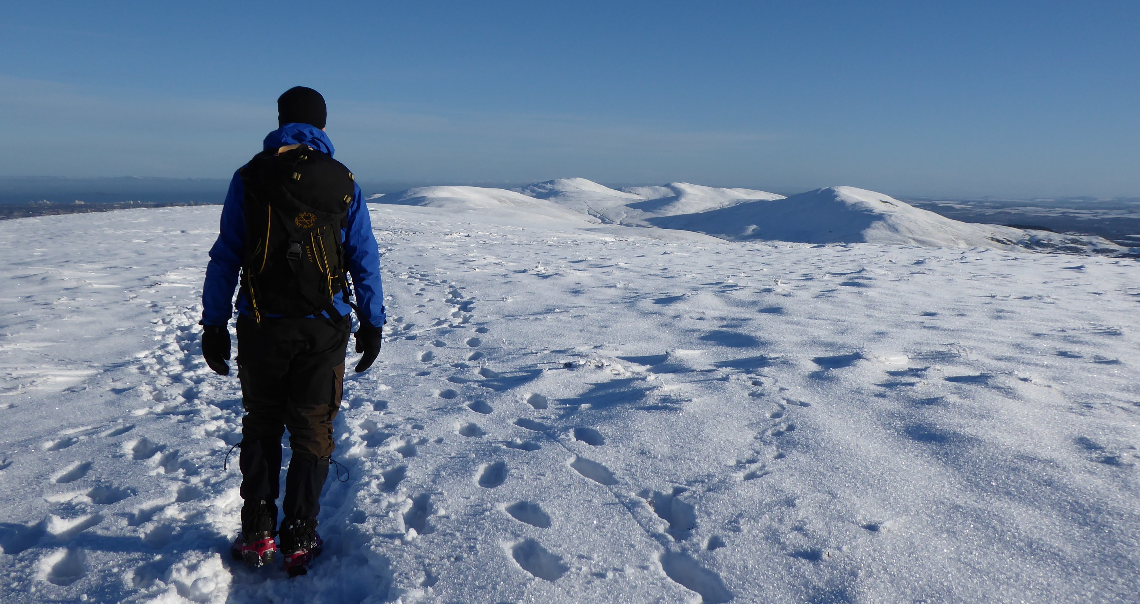
It was an Arctic-like place up there that day and the gusts dropped the windchill to minus eleven degrees. It's incredible how tough it can be in these conditions, barely able to stand in the wind and really challenged by the cold to do small, fiddly tasks with your hands. But somehow, we swapped snowshoes for microspikes and descended. 

Less than hour later, we were enjoying our picnic at the bottom, looking to Scald Law above. It gave away no hint of the winter wildness of its upper reaches. 

Fact File
Start/finish: Path northeast of Silverburn
Public Transport: Stagecoach Service 101 between Edinburgh and Dumfries
Route: Ascended path signposted at layby northeast of Silverburn on A702. Where it met a drystone wall, left the path and crossed the stream below it to ascend Scald Law via its southeast ridge. From the top, we descended the main route northeast then picked up the continuation of the outward path at the bealach between Scald Law and Carnethy Hill. Used it to return to the start.


Sunday, 28 February 2021

Black Hill - As good as it gets

This was the first time that I'd been up Black Hill, a small, rounded peak in the Pentland Hills to the south of Edinburgh. The walk was planned simply as a new route to explore, given that I'm still limited to these local hills under the ongoing Covid restrictions. Surprisingly, it turned out to be one of the most beautiful days I've spent in the hills.

Our route started by walking into the hills via the steep road from Threipmuir Reservoir. The snow-dusted branches of the trees either side made a tangled archway for our send off. As soon as we gained a little height, the view opened up and we could see the morning sun catching the tops of snow-plastered hills all around. And they were really plastered. It's been a few years since I've seen so much snow here in the Pentlands. At the top of the road, we struck out briefly across open moor before dropping down into the tight valley below Hare Hill. It was cold here, out of the sun, and the snow was dry and firm enough to crunch under our boots. 


Before we dropped down to The Howe, we picked up the line of an old stone wall that took us up to its high point on the flank of Black Hill. We peeled off from the wall here, picking our way through deep drifts to gain more height. We were still in shade as was the southern ridge of the Pentlands at our back. West Kip, East Kip, Scald Law and Carnethy formed a long line of Alpine-like peaks reaching into an Alpine-like blue sky. 


As we pulled up onto the south shoulder of Black Hill, we emerged into the sun. The full panorama of the winter wonderland was stretched out before us now and we stood there in awe, barely able to take it all in. We could see northeast towards Allermuir with its neighbouring cluster of hills and as far west as East Cairn Hill, where we'd been a few weeks before. All around us, the snow sparkled in the sunshine and made these modest hills look so incredibly beautiful. On top of all this, there was not a breath of wind, a rare occurrence on a Scottish hill. I couldn't help thinking this is as good as it gets ... in lockdown at least!


We walked north, ascending a steeper section before gaining the flat plateau that is the top of Black Hill. We wandered slowly across the top and were in no rush. We wanted to breathe it all in and make the moment last as long as possible. 


Eventually we started to drop off the far side, down into Den's Cleugh where a grouse butt provided a back rest for an early lunch. After food and flasks of hot coffee, w
e continued down to the lovely pass at Black Springs, a quiet route that sneaks around the north side of the hill. We were returned to cold shade here as the sun would never reach this place on its low winter arc.  


The route through here returned us to our start point via the track along the shores of Threipmuir Reservoir. We gazed across its frozen waters, soaking up the last of the views as Black Hill rose above us. Too often in normal times, we ignore these local hills in favour of bigger Highland peaks but today they'd given us a stunning trip in the hills.

Fact File
Photos on FLICKR
Start/finish: Threipmuir road end
Public transport: Lothian Buses no. 44 (requires a walk from the terminus in Balerno to the road end)
My route: Continued up the road beyond the Threipmuir car park and turned left at the top of the hill, passed Bavelaw Castle as the road swings to the right. Through the gate ahead then followed the path that runs east below Hare Hill. Immediately after a fenced area of regenerating woodland, went through the gate and followed a stone wall up to the left. Left it at its high point to gain the south flank of Black Hill. All the way over the top of Black Hill heading northeast then started to drop into Den's Cleugh but swung left to turn west back towards Threipmuir along the bottom of Black Hill. This route reaches a small dam which I crossed then followed the track on the other side back to the start.

Monday, 15 February 2021

Edinburgh - Ski Porty

If I was feeling frustration about not getting to all the snow up north these last few weeks, then that vanished a week ago when the snow arrived here in Portobello. It came in decent amounts too that transformed the local landscapes and gave me several days of good skiing. Of course, it came on a Monday and the skiing had to be fitted in before and after work for the rest of the week but I'm not complaining. In fact, getting out early morning meant that I could ski on unblemished snow after the overnight falls.


I love it at times like this when there is enough snow that I can ski right from my front door and out along the promenade. To be skiing right beside the sea is wonderful. You can marvel at snow lying on the beach and watch the snow-laden fronts move in from the North Sea.


From the promenade, the side streets took me up onto the High Street then onto my nearest golf course, Portobello. It's already a little higher than the promenade so the snow was thicker. The golf course gives wide open panoramas and a view to Arthur's Seat, the city's little mountain. You just need to be careful about spotting the bunkers. 


Best of all is the woodland path along the edge of the course. In the snow, in the early morning with nobody else around, it was transformed in my imagination into a boreal forest of northern Scandinavia. 


A little further away from Portobello but still accessible for skiing is the beautiful golf course at Duddingston. Its undulating fairways and woodland copses are changed by the snow into a magical, winter wonderland. I skied over the little bridges that cross the river which cuts through the middle of the course and examined tracks in the snow left by the wilder inhabitants during the night. A snow-covered Arthur's Seat dominated the view here as it's much closer and a favourite bench gave a lovely view of it with the rest of the city obscured by trees and the folds of the land. Under a blanket of white, you have no inclination that you are on a golf course. 


Duddingston is a little higher again relative to Portobello so there was even more snow and good vantages for watching sunrise or sunset. It was so magical to be skiing there by torchlight in the frozen stillness of early morning.


Those snow days were wonderful and brought fun,  immense beauty and joy. Just what was needed to lift the lockdown spirits.

Sunday, 7 February 2021

Fife - Tay Bridge and the Newport Nature Trail

This is one of my favourite short walks. Handily for me, it connects the train station in Dundee with family in Newport-on-Tay. But if that’s not your reason for walking it, then it can also be used for a wander up Wormit Hill, chilling in Newport’s cafes or just for the joy of the route itself.

Stepping off the train in Dundee, I’m immediately greeted by the double delights of the RRS Discovery and the V&A Museum. The Discovery was built in Dundee and sailed Scott to the Antarctic in 1902. The V&A Museum is a little younger, having opened in 2018. Its design is inspired by the cliffs of Scotland's north-eastern coastline and it was built out into the River Tay to recreate the prow of a ship, reflecting the city’s shipbuilding heritage and the Discovery next door. What I love most about the museum is the walkway that cuts under the middle of the building. At the right time of day at the right time of year, it floods with light from the rising sun.

It’s a just a couple of minutes’ walk from the museum to the Tay Road Bridge and its central walkway. Once on the bridge the views really open up. Looking east is the widening Tay estuary guarded by Broughty Ferry Castle. Looking west, the Tay Rail Bridge forms the foreground as the river cuts a line back to Perth and the southern Highlands. Today my eye was drawn by the contrast between the old rigging of the Discovery and the modern rigging in the port, both reaching up into a morning sky tinged orange by the dawn.


As I walk towards Fife across the bridge, I can feel that it’s very marginally uphill. This is most obvious if you look at the bridge from a distance at high tide when there is much more space between sea and bridge at the Fife end. I always stop for a moment about halfway across the bridge whether I’m walking, scooting or cycling to look back to Dundee and the Sidlaw Hills rising behind.

Once I step off the bridge at the Fife side, I’m straight onto Newport’s nature trail. Initially it cuts a quiet line behind the houses of the village, sneaking between back garden walls and rows of painted, wooden garages. There are some nice villas here, probably built by the wealthy merchants of Dundee in the day.

Before too long, the trail climbs up onto the old railway line that once connected Newport and Tayport to the Fife end of the rail bridge. On a crisp winter morning, it was a beautiful walk along the old line. Early sun drenched the tangled mass of trees that line the route and fallen leaves were frosted white by the overnight chill.

As the trail heads westwards on the hillside above town, I’m reminded of the past as I walk under old railway bridges. At times I have open views across the rooftops of Newport to the Tay and Dundee. At other times, I’m wrapped up in a tunnel of trees and bushes alive with small birds.

Just before Wormit, there’s a great view of the Tay Rail Bridge which is much closer now. I always hope that a train is crossing and I can watch it taking the final curve of the bridge into Dundee. Just beyond here, it’s the end of the line for the nature trail as a series of steps take you off the old railway and down into Wormit. 


Fact File
Start: Dundee Train Station
Finish: Wormit
Public transport: Train to Dundee; local buses run back from Wormit or Newport to Dundee.
Route: Exit the station and cross the road towards the V&A Museum, then pass under the building. Walk east along the walkway beside the river to the stairs up to the Tay Road Bridge. At the other end of the bridge, exit to the right then take the path to the left. Where it meets houses, continue straight on up Norwood. Where it meets a road, cross and continue along a dirt track beside wooden garages. Where it emerges from here, ascend the stairs ahead to the old railway line. Follow the line west. Where it next meets a road, turn left up the road then take the first road to the right. A little way along here a nature trail sign points you to a path heading into trees and back onto the old line. Follow it west, going straight over the car park that it meets. The route crosses another road after here - a path to the left just before links to Wormit Hill. Where the nature trail ends, steps head down to the right into Wormit. You can walk back the same way or walk back to the bridge along the waterfront of Newport.

Monday, 25 January 2021

East Cairn Hill and the Cauldstane Slap - Bleak and black and white

Robbers and reivers; hunted; beaten and shot; survival. These grim words headed up each paragraph on the information board at the start of the path which set out the history of the old route we were about to walk. They certainly created an air of foreboding that was heightened by the bleakness of the winter day. We'd just watched the sun barely pull itself above the peaks to the east only to be immediately engulfed in dense, low cloud, that reverted the morning to twilight. Old, hard snow speckled the fields which were parceled up by the black lines of criss-crossing stone walls. The route of the path ahead, part of the Cross Border Drove Road, was picked out in the snow so that we could trace its white line all the way up to the Cauldstane Slap, a low slung pass between East and West Cairn Hills. There was no colour to the day and the world appeared monochrome.

The Cauldstane Slap is a relatively remote spot for these parts, far to the west of Edinburgh and a bit off the beaten track. The two hills either side held a fair bit of snow and West Cairn looked quite dramatic, rising in white ramparts above the trees. But we were heading for East Cairn Hill, the highest point within the Edinburgh city boundary.

The Cross Border Drove Road and the Cauldstane Slap were used to move cattle from the Falkirk trysts into the Borders and on into England. It was a route of some significance that saw tens of thousands of cattle and sheep pass through annually at its peak. Inevitably it also earned the name of Thief's Road as it was used by cattle thieves as well as drovers.


We headed off, walking alongside an old wall initially then passing through scrubby woodland. We were grateful the temperature was below zero and the ground frozen because it looked like the route was just bog otherwise. The wettest sections had been bridged by wooden planks which were quite tricky to cross with a layer of thick ice along the top. Eventually, we pulled microspikes onto our boots and made easier work of it. 

Before the land started to rise to the Slap, we crossed a small river via a wooden bridge. A quick look at the map showed this to be the fledgling Water of Leith whose source is at Colzium Springs, a little to the west of where we were now. 

As we crossed the bridge, we looked up to the climb ahead and saw that the tops of East and West Cairn Hill were now obscured by the enveloping mist. The Slap was still clear and we plodded on, finally pulling up onto the pass after a walk that seemed much longer on the ground than it had looked on the map. We'd no sooner arrived, than the Slap was also engulfed in the mist, drawing in our world to the few metres around us.

From the Slap we set out up East Cairn Hill. It's not far and it's not a difficult walk but some deep snow drifts demanded extra effort, so we were no less pleased to see the stones of the summit cairn emerge from the gloom. There was no view of course but I loved the other worldly atmosphere imparted by the mist.

The stone cairn afforded enough shelter from the biting wind to sit a few minutes, pull on our duvet jackets and eat our picnics. Then we battled our way back off the hill in deteriorating conditions to make the long walk back.

Fact File
Start/finish: Little Vantage
Public transport: None to the start; used my friend's car given the current COVID restrictions and there is a car park at the start of the walk. In future, I would take the train to Kirknewton and cycle down from there.
Route: Path is signed from the road and it's a straight forward path to the Cauldstane Slap with waymarker posts to the bottom of the rise to the Slap. Followed the fence line northeast from the Slap to the bealach between the two tops of East Cairn and it's an easy ascent to either from there. Returned via the same route.

Saturday, 9 January 2021

Pentland Hills - City slickers

Back in the heady days of Covid Tier 3 before Christmas, my extended household and I made a camping trip to the northeast half of the Pentland Hills. This area lies within the city boundary and is the only “wild” place available to me under the higher tier rules. This has made it popular and we found all those extra feet plus the wet weather had made the normally dry, firm trails turn slick with mud. Amusingly, I had not packed my gaiters at all while Graham had grabbed from his cupboard a pair that were several sizes too small and more suited to dainty, slim ankles.

Our walking route headed out from Bonaly with a stiff climb up towards the reservoir but we turned off just before to pull ourselves up the north side of Capelaw Hill. This is my favourite hill in the Pentlands. I don’t know why because it’s not the highest or most shapely but I love the expanse of its flat top which has big views all around. These views extend southwest where the rest of the Pentlands stretch towards Lanark and north to the city below, backed by the blue waters of the Firth of Forth.

We made an undulating walk westwards next, dropping down into Phantom Cleugh and walking up over Harbour Hill (which is far from the sea). We then descended towards the popular path that comes up from Harlaw. Goodness it was busy but, like us, folk don’t have many places to go. We’d started quite late so decided to stop here for lunch as a shower of rain was moving in from the west.  I also wanted to try my new, two-person bothy shelter. This is essentially a waterproof bag that you pull over yourself and when you sit down, your backs give structure to the bag. I had tried one before and it was a great escape from the weather to eat lunch or look at the map. There weren’t too many folk around when we tucked ourselves up in the bothy shelter and once inside we became oblivious to the outside world. However, when we emerged after our picnic lunch there were loads of people, staring our way, wondering what on earth we were doing.

Our walk continued over Bells Hill next which I hadn’t been up before and descended to a quiet, hidden glen on the other side. The cambered path on the side of the hill was especially slippery as slick mud mixed with heather stems, a frustrating combination. The escape from here was even boggier and eventually we were ploughing through water to reach the main track that dissects the hills. Finally, some firm ground for an hour or so. Before too long, we turned north and walked back towards Harlaw through Maiden’s Cleugh (which sounds a bit rude).

As we came over the pass here, the golden hour was upon us with the sun sinking to the west. So was the rain upon us. Along with a stiff breeze, this dissuaded us from camping on a summit and instead we headed for the shelter of the woods. This was mid December so it was dark by four in the afternoon but a bright moon cast some light later for a night time walk back up the path. 

A peaceful night gave way to a stunning sunrise and an early walk back along farm tracks lined with winter hedgerows that sealed the trip with a little treat – a beautiful goldcrest flitting about just a foot from our faces.

Fact File
Start/finish: Bonaly village store
Public Transport: Lothian buses number 10
My route: Walked up Bonaly Road to its end at a car park then continued straight on the track. Just before the reservoir a path left through a wide gap in the forestry. This swung round the edge of the trees, climbed over a wall then ascended the north ridge of Capelaw. Followed obvious path southwest over Harbour Hill, Bell's Hill then descended into Den's Cleugh. A path and then a track head southeast along White Cleugh Burn to join the main track at Logan Cottage. Turned left then half way along Glencorse Reservoir took the path signed to the left Harlaw and Bonaly. Where this path drops down the other side and passes through a gate in a wall, turned right towards the trees. Followed this track until it meets the tarmac road then turned right. When the road ends at the cottages, took a sharp right onto a dirt track and followed this to Clubbiedean then Tordfuff Reservoirs. Crossed the dam of Torduff Reservoir and this path joined with the outward route.