Tuesday, 1 June 2021

Bridge of Orchy to Taynuilt - Mind how you go

Mindfulness is a popular concept these days. It's defined as being fully present in the moment such that we are aware of where we are and what we’re doing. It's also seen as a form of meditation and thought to be good for your mental health. I think when I'm in the outdoors, I mostly walk in a mindful manner. It's being fully engrossed in the moment that enables you to notice the fine details of everything around you and it's this that makes a walk enjoyable. I was especially mindful on a recent walk from Bridge of Orchy to Taynuilt because it rained non-stop. This forced me to find joy in the detail of the immediate vicinity as I drew in tight my cagoule hood and limited my vision to the immediate world around me. But there were plenty of pleasures ... the colours of rocks wet from the rain; beads of water on tree twigs; the sound of a stream gurgling under the path; the blaze of bluebells in the woods; staring a barn owl in the face from a couple of feet away. So what might have been a miserable plod in the rain was actually a wonderfully rich walk. 

Here are some photos from the walk.

There was a brief moment of sunshine on the first evening which picked out the grain of the bark on the pine trees.

The cold spring meant the woods were largely leafless but there was still plenty of green in the moss-covered forest floor.

One of my favourite spots on the walk was the old, stone bothy of Narrachan which provided a lunch stop out of the rain.

At Ardmaddy Bay on Loch Etive, the gorse was a splash of colour in an otherwise grey palette.

Bluebells carpeted the woods close to Taynuilt.

Fact File

Start: Bridge of Orchy
Finish: Taynuilt
Public transport: Trains between Glasgow and Fort William stop at Bridge of Orchy; trains between Glasgow and Oban stop at Taynuilt.
My route: At the bottom of the steps at Bridge of Orchy station, turn left and this is now the West Highland Way. Follow it to Victoria Bridge then take the track west which is signed for Loch Etive. It passes Loch Dochard then descends into Glen Kinglass. When it reaches Ardmaddy on the shore of Loch Etive, follow the main track over the bridge and south down the shore. There is a new hydro track through part of the glen but stay on the track on the north side of the river until Ardmaddy. When the track reaches a tarmac road, turn right and a little further on the smokery at Inverawe is reached. Cross the car park and pick up a path signed down to the river. Cross the fine pedestrian suspension bridge and follow the track up to the right on the other side. This leads into Brochroy. At the end of this residential road, turn left, then first right to Taynuilt village centre and the train station. 


Monday, 24 May 2021

Cowal - Flippin Eck

I was as happy as a pig in a puddle to be able to travel to the hills during my May holiday this year. I missed it last year of course because of lockdown. However, I suspected that more than a year of reduced activity might have taken its toll, so I opted to start with a relatively gentle walk through the Cowal Peninsula, from Arrochar to Dunoon. For much of the walk, I used the Cowal and Loch Lomond Way, one of Scotland's long distance walking trails. However, I decided on a shorter version of it that would enable me to carry a relatively light load of camping kit and food for just four days. The route also took me through some new areas which is always appealing.

The late train popped me out at Arrochar on a beautiful evening, albeit a chilly evening for early May. Given the recent cold spell, I'd packed woollen baselayers for extra warmth which I never normally do in May. It's usually the point in the year that signals my switch to summer kit in the hills. I set out from the station, contouring round Cruach Tairbeirt on a beautiful woodland path. Unfortunately, the only good spot it offered for pitching the tent was under an electricity pylon where the ground was flat and the grass short. The views down Loch Long were lovely at least, especially the next morning when the rising sun turned the Cobbler into shades of gold. The woollens were a wise choice too as the high tops were dusted with fresh snow.

A beautiful walk followed after breakfast as I trekked through to Ardgartan. Although the map shows the track passing through commercial forestry, the trees either side were actually quite mixed and the ride wide open, allowing variety in the vegetation. Then a delightful path wound its way down to the loch through the most beautiful woodland, all lush and green from the fresh spring growth.

My trail flirted briefly with the loch shore before climbing steeply up Coilessan Glen to eventually pop out on the high pass below The Brack, the craggy peak that dominates this place. This was a wild, windswept spot but a blue lochan reflected the sunny sky and offered a spot to rest a while against a rock. The view stretched to more craggy hills extending westwards and I knew my path was somewhere amongst them. 

A long, long descent from here took me down to Lochgoilhead through pretty woods with tumbling waterfalls and pools that would have been hard to resist if it had been warmer, or at least more like the usual weather for May. I rounded the head of the loch and headed into ugly territory now with blanket forestry in the process of being harvested. Somehow, I still found a lovely camp spot by the river which was backed by a stand of remaining pine trees and a rusty wire fence, a welcome facility for hanging up wet waterproofs and damp socks to dry in the evening sun. This was bliss for me to be out in the tent again. The river gurgled, birds tweeted in the trees and the evening passed pleasantly. I never know how the time passes in the tent but somehow it goes at a slower pace, collecting water, making supper and just watching the world go by.

The evening was idyllic but the next day less so. Light rain at breakfast time gave way to heavy rain for the rest of the day. I crossed another high pass north of Beinn Bheula where the rain turned to sleet and the lochan reflected a grim, grey sky. As the day wore on, the rain got heavier and I was ready to stop walking, get dry and camp as soon as any opportunity arose. However, no spots appeared until late afternoon. I was walking now down the west shore of Loch Eck and hoped that the flatter ground around a ruin marked on the map might provide a spot. It seemed to take forever to get there but eventually the broken, moss-covered walls of the ruin appeared. It provided a stunning camp spot. Mature trees overhung the perfect green grass which was dotted with bluebells and primroses. A pebble beach picked up where the grass ended and the sound of waves washing over stones filled the air. It was perfect except my heart sank when I unpacked and realised that the rain had somehow got through to my sleeping bag. But no matter what, you always feel better once you've changed into dry clothes and the stove is on for a pot of tea. I managed to get some sleep too by just using the dry half of the bag.

The wet sleeping bag meant that the next day would have to be the final one of the trip. I continued down the shore of Loch Eck, which was a stunning walk. Even the low hills here were dusted with fresh snow which contrasted with the vibrant yellow of the trail-side gorse. 

At the south end of the loch, I headed to a place that I had wanted to visit for a number of years called Puck's Glen. It's a delightful gorge walk built in Victorian times with little bridges spanning the river and places where the path is just a narrow ledge carved into the rock. There are waterfalls and pools, mosses and ferns. It was a magical walk.

My trip ended on the Dunoon ferry as it headed out of the harbour and made its way across a slightly bouncy Firth of Clyde to Gourock. When I got home I realised how my sleeping bag got wet. It turns out that I own two orange rucksack rain covers and I had managed to pack the smaller of the two which didn't fully cover the rucksack. Flippin Eck!

Fact File
Photos on Flickr 
Start: Arrochar & Tarbert train station
Finish: Dunoon
Public transport: Train to Arrochar from Glasgow; ferry from Dunoon to Gourock which connects with the train to Glasgow
My route: On leaving Arrochar & Tarbert station, turn right at the bottom of the steps and follow this path through to Arrochar. Continue around the bay and opposite a car park on the far side, the hill path to the Cobbler starts and is signposted. Where the path meets a track, turn left and follow this track south. This is now on the Cowal and Loch Lomond Way and I followed it as far as Glenbranter. I peeled off here to walk down the track along the west shore of Loch Eck. It emerges at Benmore botanical gardens (which are well worth visiting) and the trail to Puck's Glen starts opposite the gardens visitor centre. 

Friday, 30 April 2021

Gear Review - Snugpak Jungle Blanket

One of my best purchases of equipment recently has been this outdoor blanket, the Snugpak Jungle Blanket. It's been such a wonderful addition to the pack this winter for day walks, picnics and bird-watching. I've also used it for relaxing in the garden or sitting on the promenade when we've been able to meet other households outside during the pandemic. Over the colder months, it's been such a joy to snuggle up underneath it and it adds an incredible amount of warmth when lingering outdoors. 


The blanket has a ripstop nylon material on the outside which is water resistant and a softer feeling material for the inside layer, with synthetic insulation sandwiched between the two. It measures approximately 196cm by 159cm. For packing it can be scrunched down to roughly 20cm by 15cm in the stuffsack provided. It weighs 715g and comes in olive or black. At that weight, I wouldn't take it on a camping trip on top of carrying all my camping equipment but it's easily carried for day trips in the rucsack or bicycle pannier. I bought a blanket for myself and one for my friend on Amazon and the price seemed to vary at different times between £25 and £30.


I've found the blanket to be incredibly practical and really cosy. It's so much warmer than just putting on an extra layer or duvet jacket when you stop because you can cover your legs too. Now I can't wait for the colder weather to return so I can snuggle up in it again. 

Monday, 19 April 2021

Pentland Hills - Way out west

With Covid restrictions finally easing, it was great to get back out wandering and camping in the hills. Mind you, I didn't go very far. With it being the first weekend without travel restrictions and the last weekend of Easter school holidays, I guessed a lot of people might be on the move. So I avoided them by taking a short bus ride to West Linton for a wild walk in the far western hills of the Pentlands. Another guess of mine ... that it would be quiet out there ... it was.

Of course, there's a reason for that part of the Pentlands being quiet. The hills are considered quite dull, just pudding-shaped lumps with few footpaths but lots of heather and bog. I didn't mind as it was good just to be out for a rugged tramp across the hills. Plus I did find a few interesting spots in this otherwise featureless landscape.

I left behind the banks of daffodils on West Linton's village green for a long walk north to the Cauldstane Slap, a low pass through the hills. This is the old drove road and is also known as the Thieves' Road because of the cattle and sheep rustling that used to go on there. As I passed through Baddinsgill Farm at the start of the track, I was surprised to read a sign asking walkers to look out for any suspicious activity. Apparently livestock theft is still rife here today.


I'd been at the Cauldstane Slap back in January in the snow to climb East Cairn Hill but this time I headed up West Cairn Hill. Its modest little top already felt quite wild and that feeling was enhanced as I trekked westwards through empty moors. A thin path soon fizzled out and I plodded through deep heather to make progress.

The rolling hills were cut suddenly by a rocky defile called Wolf Craigs. So often the names of landscape features take us back into the past and I can only imagine there was a forest here hundreds of years ago which echoed with the call of wolves. 

I was grateful for the firm ground of my next hill, Craigengar, after the boggy valley at Wolf Craigs. The twin cairns on top of Craigengar were a fine viewpoint where I could see my day's walk behind and ahead of me. It was a thirsty plod along the top of this hill though as I was out of water. Boggy as it was at Wolf Craigs, the stream marked on the map was actually dry. So it was a relief to eventually drop down into a steep gully cradling the tributaries of Medwyn Water and listen to the gentle babble of the burn. It was too tempting to laze here, back against a rock, in warm sunshine, drinking cool water as fast as I could filter it. I don't always filter water out in the hills before drinking it but there were sheep around here, so better safe than sorry.

It was late afternoon now and the heat had gone from the sun as I pulled up onto White Craig. This was another interesting spot with a scatter of boulders to clamber through on the way up and an old, lichen-covered cairn on the top. It felt little visited.


The final stop from here was Black Law where I pitched the tent on a spot I'd used before with big open views. The evening air was full of sound with skylarks singing above, grouse gurgling in the heather and noisy geese somewhere nearby.

A windless, still night passed and gave way to a grey dawn and drizzle. A long walk took me past the Covenanter's Grave where I turned east for West Linton and the city.

Fact File
Start/finish: West Linton
Public transport: Stagecoach bus 101/101A Edinburgh to Biggar/Dumfries
My route: Off the bus cross the Lyne Water then take the first road to the right, Medwyn Road. Continue to the road end which continues as a track to the Cauldstane Slap. From here, follow the wall up to the left for West Cairn Hill then continue along its southwestern flank (bit of a path along here) then drop down through heather to Wolf Craigs. Climb the northeast flank of Craigengar to the two cairns marked on the OS map then continue southwest along its top and pass to the north of Millstone Rig. Cross the Medwyn Water in the gully between Millstone Rig and White Craig then climb to the summit of White Craig. The path over Black Law and passed the Covenanter's Grave can be seen from here and joined by dropping down a little. After the grave, the path drops to a dirt track and follow this east to rejoin the outward route at the golf club.
Info: More on the Covenanter's Grave HERE and on East Cairn Hill HERE


Monday, 5 April 2021

Portobello - Swimming beginning

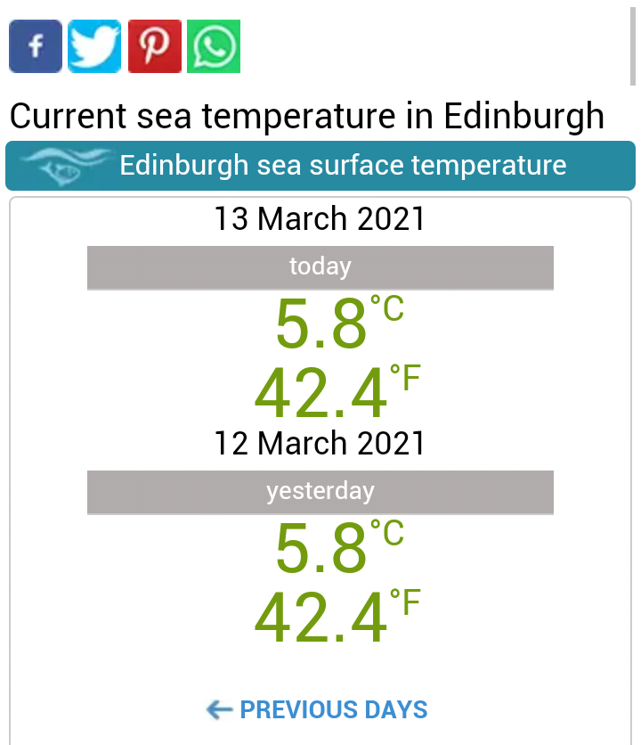
Despite the current cold snap, I think it’s fair to say that I’ve survived my first winter of wild swimming. The sea temperatures here in Portobello are starting to rise again from a low point of 5.8 degrees Celsius. The evenings are drawing out as well, bringing to an end the simple joy of being in the water after dark. I’ve discovered that I love being in the water, although I certainly need to get swimming lessons to improve my technique. I’ve realised that I don’t feel the cold too much either.  But I’m very much a novice, so I thought it might be useful to share here how I got started.


First of all, I started swimming in August when the sea temperature was a balmy 13 degrees. That way, I gradually got used to the cold as it slowly dropped into single figures towards Christmas. I’ve discovered that I like to stay in the water for quite a while and therefore I use a wetsuit. Some people use just a swimming costume but the time you can stay in the water is limited this way. With my wetsuit on, even in the coldest temperatures, I can stay in the water for much longer and don’t have to worry at all about getting cold. I also enjoy the added buoyancy from the wetsuit. When the sea temperature dropped to eleven degrees, I added neoprene swimming gloves to my ensemble and at ten degrees I put neoprene socks on. Once the water was below 10 degrees, I had to put thick Vaseline on my lips to stop them chapping. I always wear goggles, ear plugs, and a red swimming cap for visibility. I slip on a pair of cheap flip flops for walking the 30 metres from the front door to the beach. These are left on the groyne while I’m in the water and I always worry that a dog will run off with them.

Of course, that proximity to the beach is a big bonus. When I’m finished, I just walk out of the water and right into the shower. I’ve formed the habit as well of filling a bucket with warm water and placing it at the front door. That way, if my hands are cold, I can warm them enough to use the house key and it also allows me to wash sand off my feet before stepping indoors. I keep the wetsuit on when I go into the shower and that way, I can give it a good rinse while I’m in there.  The first wetsuit I bought was quite a cheap one (£80) and it was a nightmare for getting on and off. After only a few uses, the seams came apart and I got a refund. This allowed me to buy a slightly more expensive one (£120) and what a difference that made for just another £40. The suit was made of a much softer neoprene which was a lot easier to put on and take off, and it has lasted well.

One other thing that helped me get started was watching the weather forecasts and tide tables even more closely than I usually do. Perfect swimming conditions are high tide and a light westerly wind with small or no waves. Here at Portobello, winds from the east, northeast, north or northwest make the sea rough and can leave a swell for several days afterwards, neither of which are good for novice swimmers. Of course, it only happens on a handful of occasions that you get a flat calm sea. As well as the Met office general forecast and the tide tables, I also use two other websites. The first, https://seatemperature.info/edinburgh-water-temp gives an accurate reading of the surface water temperature for my location and gives a forecast of wave heights.

The second site I use, www.thebeachguide.co.uk/sea-temperature, also gives temperatures but as a map showing the different sea temperatures around the UK. I think it’s not as accurate as the first but I really like the colours and enjoyed watching them change as the temperature dropped over the winter months. It’s coldest in February and March.

There are a number of reasons for starting swimming. I was looking for an exercise that complemented my other activities and would maintain my flexibility in the years ahead. It’s also been something new to try and possible to do close to home during the pandemic. One big advantage as well is that it’s a short activity that I can fit in at lunchtime or between other things and doesn’t need much planning or preparation – just pull on the wetsuit and go. Lunchtime swims are possible now that I’m working from home during the pandemic and I find I’m really refreshed afterwards for the rest of the working day.

Of course, it’s not all about swimming. Mostly, I enjoy just being in the water and dreamily drifting away from shore. And sometimes I just float.


Kit Notes
Wetsuit - TRN Orca 
Gloves - C-Skins 3mm neoprone swimming gloves. Really important to have proper swimming gloves so they are a tight fit which enables the water to be trapped and warmed by your body temperature. This applies to all the kit but especially the gloves. Cold hands can be crippling and are likely to reduce the time in the water.
Socks - Lomo neoprene swimming socks
Hat - Lomo silicone
Goggles - Speedo
Ear plugs - Zoggs junior 


Saturday, 20 March 2021

East Lothian - Camp stove picnic

One thing I've missed over the recent lockdown is getting away camping. In particular, I miss the fun of cooking at the tent in the evening and the reassuring roar of the camp stove as it sparks into life. But I had an idea recently to at least recreate one of those elements by cooking a hot lunch on the camp stove while out for exercise. And the perfect place for this was the Pencaitland Railway Trail. It's one of my most used local cycle routes and I've really appreciated it over the last year of the pandemic. So my friend Graham and I packed up our bicycles and headed out there on a grey, cold day that felt neither winter nor spring. 

We soon cycled by what we now call "lockdown bench" - a place where we used to sit and have a flask of coffee when we were out cycling in the first lockdown. A little further on though, we pulled into our favourite spot where a couple of picnic benches are set on grass beside allotments. It's a lovely place, tucked away from the world and really peaceful. There are flower borders which today were dotted with snowdrops. In summer they are full with wildflowers which buzz with bees. There is woodland all around so the air is always filled with birdsong. We wrapped up in blankets, set up our camp kitchen and got cooking. Our hot lunch today was pan fried salmon and asparagus served with our favourite Idahoan instant mash potatoes. This was followed by Gu gluten free cheesecakes washed down with coffee. The cheesecakes were really handy for transporting by bicycle and miraculously arrived in one piece. 

Quite a feast! The only downside, having eaten so much, was cycling home again. 

Friday, 12 March 2021

Scald Law - Eleven below

There's an old saying, in outdoor circles at least, that in summer Scotland has hills but in winter, it has mountains. Although our hills are not high, the northerly position exposes them to a harsh climate in winter which makes them much more challenging than you might guess from their height. It might be a stretch to apply this logic to my lowly local hills, the Pentlands, which only reach 500 metres or so. However, the thought was in my mind recently as pictures appeared on social media of a significant avalanche on Turnhouse Hill, barely a bump in the Pentlands. Then a walk up Scald Law really drove home the message as we ascended its snow-covered slopes into testing winter conditions. 

We'd walked in from its south side, just as the sun was clearing the morning horizon. It cast an alpenglow over Scald Law above which stopped us in our tracks as we gazed up. Like all tricks of the light, it was an ephemeral moment and we soon continued along the main path. It was well trampled in the snow and took us through stands of gorse and rough pasture to the lower slopes of the hill. 

Where we met a drystone wall, we left the path, strapped on our snowshoes and headed across country. We made progress by stitching together the lines of deeper snow which was soft powder in some places but wonderfully hard-packed in others, perfect for the snowshoes. 

As we climbed, the flush of colour from the dawn sun drained from the land and a monochrome, winter world stretched out below us. When we gained more height, the character of the snow changed and we marvelled at the beautiful sastrugi, the wave-like patterns in the snow created by the wind. Of course, it was a forewarning of the conditions up ahead. 

The final section to the top of Scald Law was steep. It's steep in summer when it's grass but in winter, under snow, it's really steep. We were grateful that the snowshoes had crampon spikes to bite into the hard snow but I think we were probably stretching the limit of them. However, no sooner had we pulled onto the top than we didn't need them as it was mostly scoured of snow by the wind that blasted through. 

It was an Arctic-like place up there that day and the gusts dropped the windchill to minus eleven degrees. It's incredible how tough it can be in these conditions, barely able to stand in the wind and really challenged by the cold to do small, fiddly tasks with your hands. But somehow, we swapped snowshoes for microspikes and descended. 

Less than hour later, we were enjoying our picnic at the bottom, looking to Scald Law above. It gave away no hint of the winter wildness of its upper reaches. 

Fact File
Start/finish: Path northeast of Silverburn
Public Transport: Stagecoach Service 101 between Edinburgh and Dumfries
Route: Ascended path signposted at layby northeast of Silverburn on A702. Where it met a drystone wall, left the path and crossed the stream below it to ascend Scald Law via its southeast ridge. From the top, we descended the main route northeast then picked up the continuation of the outward path at the bealach between Scald Law and Carnethy Hill. Used it to return to the start.