Sunday, 9 October 2022

Fife - Last of the summer rides

The nights are drawing in and the temperature is dropping but before the season began its change into autumn, I fitted in a last summer cycle trip in Fife. The hot, sunny days through golden fields ready for the harvest, captured the essence of this time of year.

The ride headed northeast out of Markinch using the route of the Fife Pilgrim Way along field margins, farm tracks and ancient paths. The first section was especially enjoyable by bike, pedaling along between fields and hedgerows on single track baked hard by the summer sun. 

We soon left the fields behind to climb gently into the woods and forests of Clatto Hill. This section had a remote and empty feel to it that was hard to explain given its proximity to reasonable sized towns. Perhaps it was because we stuck to gravel tracks and forest rides so never crossed any roads. 

A lovely descent through Clatto Den took us to Clatto Reservoir. It was an idyllic spot in the sun with waterfowl on the loch and dazzling blue damselflies flitting around the bright pink of the rosebay willowherb that lined the margins.

Our next path cut a meandering line across the fields before bringing us out in Ceres at the Bishop's Bridge. It was built in the 17th century and the gradient of its arch plus the cobbled surface defeated our modern day bicycles and we had to push over. 

Our ride continued northeast out of Ceres on countryside paths and then up a steep farm track onto Kinninmonth Hill. The stiff climb was worth the effort for the view back over our route and to the Lomond Hills beyond. The climb had also taken us to our wee campsite for the night at Drumcarrow Farm. It was basic, just a field beside the farmhouse with one toilet and a shower in a portakabin, but it was a lovely spot. The view was open and extended over rolling fields and woods. House martins twittered overhead and the craggy hill of Drumcarrow Craig behind the farm provided a pleasant walk to fill the evening.


The campsite was also our turnaround point and next day we made our way back to Markinch on quiet, meandering back roads.

Fact File

Start/finish: Markinch
Public Transport: Edinburgh to Perth and Edinburgh to Dundee trains stop at Markinch.
Route: Fife Pilgrim Way from Markinch is all rideable with a loaded bike except for a couple of very steep but very short sections. It goes right by the campsite. Returned to Markinch via the National Cycle Network route through Craigrothie, Coaltown of Burnturk and Star.

Monday, 19 September 2022

Fife - Running in a quiet corner of the county

The north coast of Fife is a bit of a hidden gem. While Tentsmuir, Tayport and Newport are well visited, the coast west towards Newburgh is much more quiet. But the shore path here is beautiful and has become one of my favourite running routes when I'm staying in Newport with family.
 

My run starts at Wormit Bay beside the memorial to the Tay Bridge Disaster. On 28 December 1879, the first rail bridge collapsed in a storm as a train was passing over it. It's thought that 75 people were killed in the accident and that the cause was poor engineering design. Today the memorial is a peaceful spot with Dundee and the Sidlaw Hills providing the backdrop for the rail bridge that was built to replace the original and still stands today. 


A single track, dirt path undulates west from the memorial, dipping in and out of woods and opening up views through the trees over the Tay and the Carse of Gowrie. In spring and summer the coastal woodlands here are a riot of colour with many types of wildflower. Once I also caught sight of a fox on the path ahead, the dappled sunshine picking out the rich reds of its coat. 


After a few kilometres, the path arrives at Balmerino, a pretty cluster of cottages along the beach. Here I like to detour to Balmerino Abbey as its decaying ruins and overgrown grounds are a peaceful haven to spend a few minutes and catch my breath. The abbey dates from the 13th century and within its grounds is one of Scotland's oldest trees, a sprawling Spanish chestnut more than 400 years old.
 

From the abbey, I run along the Monk's Road, an old path that loops through the woods back to the coast. Spring is my favourite time to be here because the woodland floor is thick with wild garlic and the path just a narrow line through the dense vegetation.


On the return leg along the coast path, I'm feeling the miles and every descent where a stream has cut a mini gorge on its way from the fields to the sea. I'm happy when my feet hit the flat path again at Wormit Bay.  


Fact File
Start/finish: Wormit Bay
Public transport: Stagecoach bus 77 
My route: Follow the Fife Coastal Path west from Wormit Bay to Balmerino. It joins the dead-end road here. Stay on the road a couple of minutes up the hill to visit the abbey. The roads here are single track and have barely any traffic on them. On the return take the road to the right, The Neuk, and then take the Monk's Road path signed to the right. Where it meets a road turn left, then left at the next junction then take a track down to the coastal path passed the Balmerino beach hut (ice cream, drinks) to return on the same path to Wormit Bay.  

Sunday, 28 August 2022

Cairngorms - To the heart of the map

Ordnance Survey map 43 is probably one of my favourite maps. It covers such delights as the Cairngorms massif, the pinewoods of Mar Lodge, the upper reaches of Glen Feshie and the Atholl Munros. Slicing through all of this is the long line of a path which starts in the north as the Lairig Ghru and crosses wild country to pop out further south at Blair Atholl. Whilst I'd walked either end of this line, I'd somehow never got round to walking the whole route and the wildest terrain in the middle. My May holiday this year finally put that right with a crossing that took me through the heart of the map.

I started walking south from Aviemore which itself is just off the map but it wasn't long before I was climbing up through the ancient pinewoods of Rothiemurchus and into the deep defile of the Lairig Ghru. The Lairig Ghru is a dramatic route which cuts through the 4000 foot Munros that rise in sweeping, bouldery flanks on either side of its high pass. 

I'd hoped to camp high here for the first night out but the wind howled through and I had to descend to the other side to camp by the river. It was still a beautiful spot, nestled below the rock architecture of Cairn Toul, Braeriach and Ben Macdui.

With plenty of food in my pack, I could afford a detour to the east for the next couple of days to spend time among the pinewoods of Mar Lodge estate which are regenerating under the ownership of the National Trust. Heavy downpours doused the forests as I walked but afterwards I could enjoy the petrichor, the earthy smell after the rain. As well as a wander through the woods, I wanted to take time to explore an interesting landscape feature called Clais Fhearnaig. It's a glacial melt water channel that cuts a deep gash through the hills between Glen Lui and Glen Quoich. It was a fabulous walk with a secretive path meandering through crags and lochans.  

At the far end of Clais Fhearnaig, I picked up a high level trail that skirted the upper fringes of the pine woods to take me to the top of Creag Bhalg, a little hill with a big view. It felt empty and open up here, and the dark skies glowering overhead added to the sense of wildness. The Cairngorms were stretched out to the north and the view south disappeared into the rounded lumps of the Glen Ey hills. I pitched the tent high where the pines were thinning out, taking the opportunity for a high camp as bigger winds were forecast to move in the next day. Things didn't quite go to plan.

The winds arrived early, around 11pm that night, and were accompanied by heavy rain. Both battered my tent high up on the hillside. The winds got so bad that I was worried the tent would come down so I packed up all my kit and sat dressed and awake, bracing the main pole of the tent against the gusts. When the heavy rain eased around midnight, I took the opportunity to break camp, find the path off the hill in the darkness and descend to the glen. By the time I was on the main track in Glen Derry, the wind still hammered through but the rain was off and the skies cleared so that I didn't even need the head torch on.  It was actually incredibly beautiful walking through the woods at midnight with a few stars twinkling and a paleness on the horizon where the summer sun had not fully set. After a short walk, I was re-pitched in the shelter of the lower pines and back in my sleeping bag by 2am.

The next day's walk took me south to the tumbling waterfalls of Linn of Dee and then west back into the bigger hills. I was heading now to the ruin of Bynack Lodge. Between me and it were two river crossings. The first, the Geldie Burn, is well known in hillwalking circles and I'd a degree of nervousness as I approached. The word "burn" is a bit misleading as this is a wide river but it was no trouble that day being quite gentle and shallow. The second crossing was the Bynack Burn and I found it a little more tricky as it was narrower and faster but again, I was across without too much trouble.

I'd arrived now at Bynack Lodge, a beautiful but remote spot if ever there was one, that sits right at the heart of map 43. The ruins were extensive and more of a settlement than a single lodge with the remains of several outbuildings and a set of steps that would have originally led down into an underground cold store. The ruins were enclosed by a drystane dyke and softened by a cluster of larch trees. There was a large area of cropped grass around the lodge where you could have pitched 50 tents and still had space. The sun shone and the absolute peace was broken only by the gurgle of the river and the chirping of chaffinches in the trees. I had a wonderful, relaxing evening pottering about my tent, exploring the ruins and soaking up the wild atmosphere of this remote place. After bed, heavy rain came on and hammered down all through the night. Next morning, the rivers were swollen and I wouldn't have been able to make the crossings had I passed a day later.

But the sun was out again as I continued my journey south. A good path picked its way through the watershed of the Geldie and the Tilt, and passed the remote waters of Loch Tilt which were sapphire blue under a sunny sky. I climbed a little top above the loch for a better view and sat a while munching a muesli bar. It was idyllic and empty and I wondered how many other people had ever sat on this top. I thought not many.


The route passed now into the narrow, upper reaches of Glen Tilt and was dominated by the massive bulk of Beinn a'Ghlo, the Munro that forms the east wall of the glen. It looked impressive from this angle, all bulk and presence. The narrow path clung to the hillside above the river which had cut a deep, rocky gorge as it approached the Falls of Tarf. The Falls are beautiful and would no doubt be a major tourist attraction if they weren't so remote. 

This was me in familiar territory now and all that remained was the long walk down Glen Tilt to catch the train at Blair Atholl. I love a wander through Glen Tilt as it has such variety in its landscape with woods, rivers, mountains, pastures and beautiful old, arched bridges. It is a long walk though so I split the miles with another night out in the tent at a favourite spot to the west of the main route down the glen. I'd only used the spot in winter previously but how beautiful it was in early summer with trees in fresh leaf around the pretty bridge and the air filled with the calls of summer songbirds. 

This left a short walk the next day into the village to complete my crossing of the map. As well as being a fabulous walk in its own right, I was delighted to have discovered the wild country at the heart of map 43.

Fact File
Start: Aviemore
Finish: Blair Atholl
Public transport: Edinburgh/Glasgow to Inverness trains serve Aviemore and Blair Atholl
My route: South out of Aviemore, picking up the Lairig Ghru at Coylumbridge. At Corrour Bothy, took the higher eastbound path to Luibeg Bridge and Derry Lodge. Took path up into Clais Fhearnaig about halfway down Glen Lui. From Glen Quoich side, picked up a trail that ascends through woods and passes to the west of Creag Bhalg. A path goes from this trail to the top of the hill. Descended to Linn of Dee and walked west to Whitebridge then south to Bynack Lodge, passed Loch Tilt and through Glen Tilt. 

Monday, 30 May 2022

Glen Lyon - The Praying Hands

Tucked away in a hidden corner of quiet Glen Lyon is a fabulous rock feature called The Praying Hands. I'd been desperate to visit since first becoming aware of it as the photos I saw online looked very atmospheric. A spring camping trip provided the opportunity to finally get there. 

It wasn't a long walk to The Praying Hands but it was a pretty walk through springtime woods alive with bird song and the call of the year's first cuckoo. The track crossed the River Lyon by a vehicle bridge then traveled west before heading into the hills at the idyllic cottages of Balmenoch. A short pull alongside gently tumbling waterfalls soon had us standing below The Praying Hands. 

I was mesmerised. It was such a beautiful spot with the rock perched precariously on a prominent plateau that gave a commanding view of this part of the glen. Their situation and their very appearance must have made The Praying Hands an auspicious place for the ancient people who lived close by. It was hard to drag ourselves away as they seemed to have some magical pull on us as well.

However the short walk to The Praying Hands was not enough to fill a weekend trip, so we continued further up the glen and pitched the tents at an inviting spot by the river. Freed from our heavier camping kit, we set out to climb the Corbett that rose above the head of the glen, Meall nam Maigheach. A shallow gully with craggy boundaries provided a pleasant pull onto the ridge and revealed a ring ouzel, also known as the Mountain Blackbird. It looks like a blackbird but has a necklace of white feathers and inhabits these higher, wilder places.

The walk along the ridge to the summit was long and rough with a pathless trudge through deep heather and peat hags. But the views were superb and from the top I could look back to a couple of key moments in my life. To the south the view was filled by the Tarmachan Ridge. It was the first hill walk that I ever did with my friend Graham 27 years ago and Graham was standing beside me now on the summit today. To the west I could look further back at the pointed top of Stuchd an Lochain, the first Munro that I did on my own. That must have been about 30 years ago! 

We sat a while on the top beside a little lochan that reflected the blue sky above before making a more direct descent to the glen. Eventually the faint outline of a path alongside the river guided us back to the tents. The short evening left enough time for cooking supper, sipping tea and watching the sun set behind Meall nam Maigheach.

A slow start the next morning allowed the rising sun to clear the ridge to the east and dry the dew from our tents. It was then a short amble back out though we couldn't resist their pull as we passed and made another visit to The Praying Hands.


Fact File
Start/finish: Camusvrachan, Glen Lyon
Public transport: None to the start. I took the train to Dunkeld where Graham met me with his car but I have previously accessed Glen Lyon using the bus to Aberfeldy with the folding bike and then cycling up the glen.
Route: Crossed the bridge over the River Lyon immediately south of Camusvrachan and turned right when it met another track. After a pretty pond, reached cottages at Balmenoch and opposite the cottages on the west side of the river a grassy track heads uphill. Further up it's easy to see The Praying Hands to the right above you. Continued up the west side of Gleann Da-Eig and gained the ridge of Meall nam Maigheach at its lowest point just south of Creag nan Eildeag. Straightforward walk southwest to the top. On the return, we skirted the crags then descended to the bottom of the glen. A faint path traveled back on the west side of the river and made a pleasant walk.

Monday, 2 May 2022

Borders - Dollar Law

Some trips are not about having the biggest adventure or covering the most miles in the hills. Some trips are just about finding a nice spot for the tent and enjoying the evening pottering around your temporary home. This was such a trip.

Dollar Law sits at the head of the Manor Valley to the south of Peebles, in an area of hills I have not managed to visit before now. But this sunny, spring day created the perfect opportunity to get acquainted with them. Our route climbed up through sheep farm country with curlews calling mournfully in the fields while skylarks sang above. A steep pull put us up onto the heathery ridgeline but it was bone dry up here and we soon had to drop back down again to collect water, a slightly dispiriting diversion. 

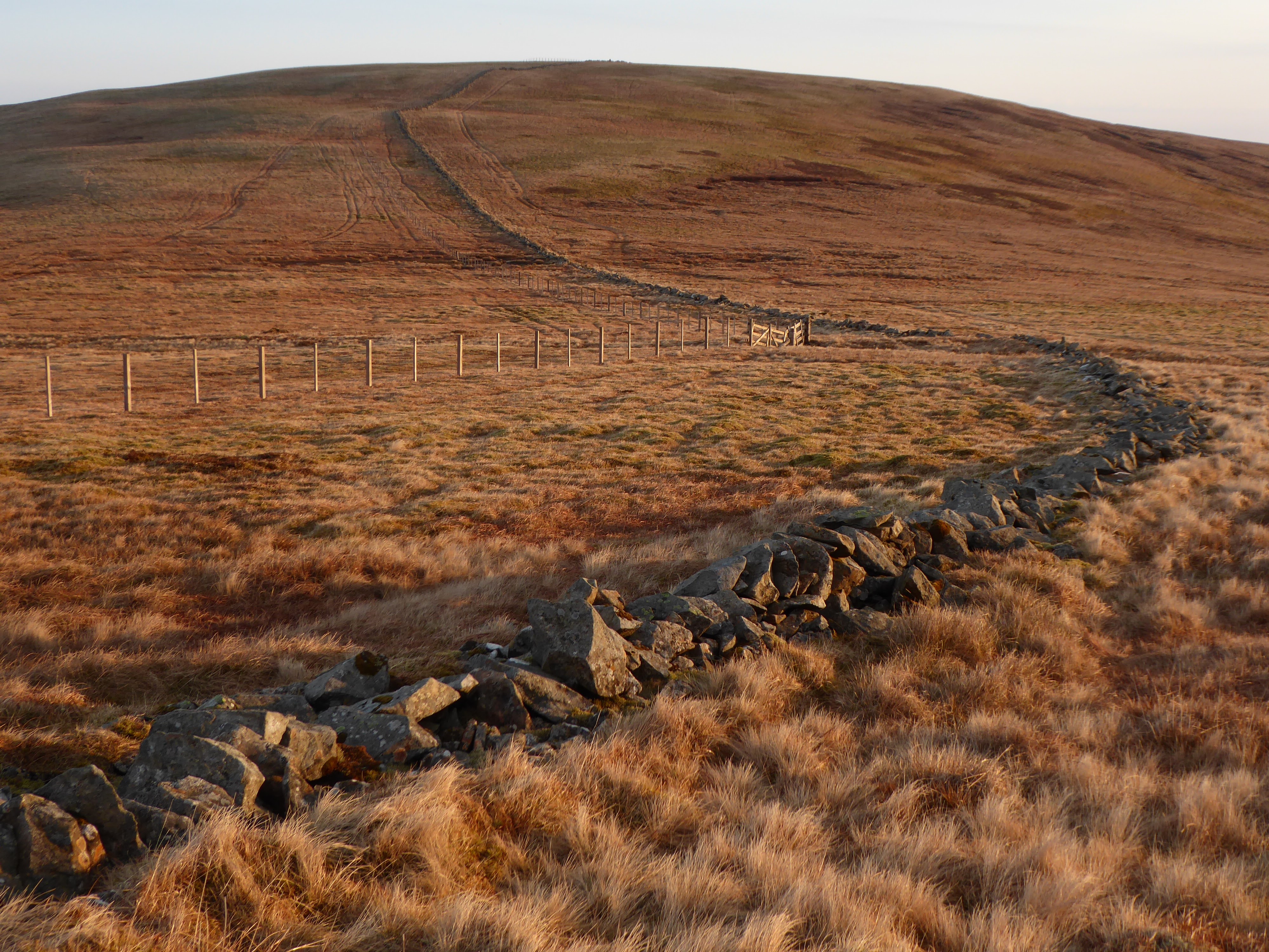
Weighted down with enough water to get us through the night, we continued west along the ridge to a flat bealach just below the top of Dollar Law, a perfect spot for pitching the tents. This high place gave wide open views. When you think of hills in Scotland, you more often than not picture the Highlands but here in the Borders hills and ridge lines filled every compass point to the horizon. Culter Fell dominated the view to the west with Tinto just poking above. 

The sun dipped and cast a golden light over our tents. Later it set with quite a spectacle, appearing as a bright red ball that dropped behind Culter Fell. It was equally beautiful the next morning when it rose to the east and our camp spot was perfectly perched to enjoy both sunrise and sunset.

After breakfast it was an easy stroll to the top of Dollar Law but a knee-crunching, steep descent to the valley floor to walk back.


Fact File

Photos on Flickr click HERE
Start/finish: Manor Valley road at the start of the track to Old Kirkhope farm.
Public transport: None so we used my friend's car.
Route: Walked up the track to the old farm at Kirkhope and skirted to the left of the buildings to start climbing the grassy ridge above the river opposite Southey Hill. Followed the fenceline here for much of the way and gained the ridge at Newholm Hill. Picked up a path running southeast over the shoulder of Dollar Law and camped on the large flat area to the north of Fifescar Knowe. For the return, we dropped directly northeast of Dollar Law, coming down the side of plantation to rejoin the road to walk to the start.

Friday, 8 April 2022

Southern Highlands - Backpacking from Callander to Aberfeldy

I love a multi-day walk. It conveys the sense of a proper journey with a start and a destination. And using ancient paths on a walk provides a connection to the past, to a time before cars when people made long journeys by foot. I love the simplicity of it as well. Everything I need for a few days out is on my back and all I have to do is to walk, to put one foot in front of the other. I did have to map read as well though on this trip as I had not walked much of this route before and even where I had, it was many years ago. It looked fairly straightforward but that was deceiving as the tail end of winter created challenging underfoot conditions and some adverse weather to contend with. 

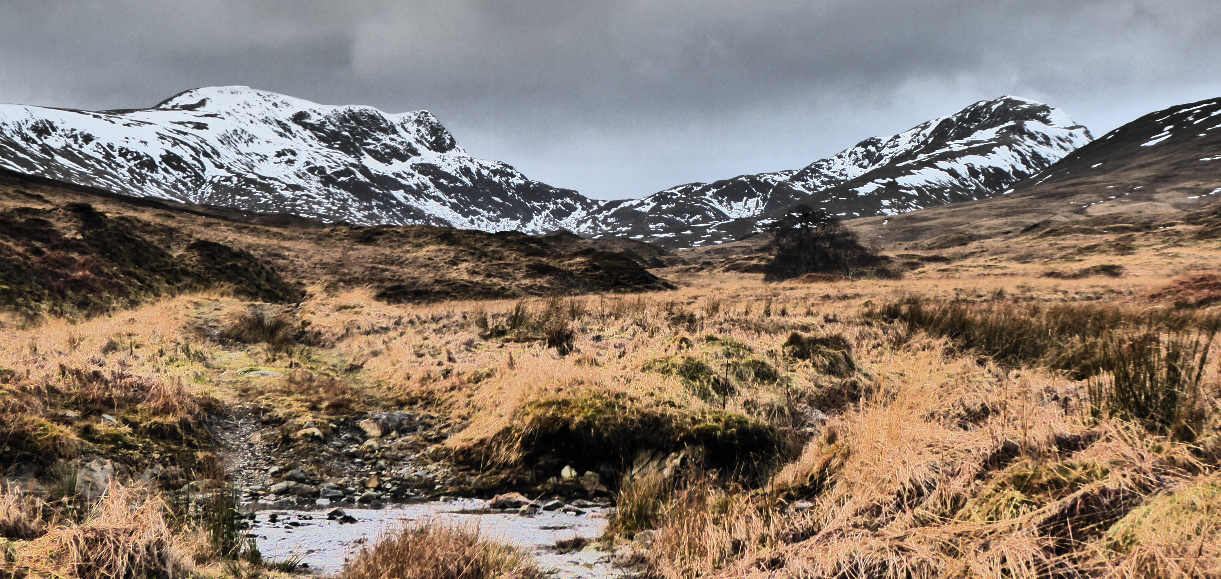
It was pleasant enough though when I set out from Callander in early afternoon. The track to the farm at Braeleny climbed into the hills and crossed to the south of the snow-dusted peaks of Ben Vorlich and Stuc a'Chroin. The inseparable pair provided the backdrop for the first night's camp spot above the river. It was a hard spot to find as the ground everywhere was saturated from the recent snow melt and I had scouted up and down for well over an hour.

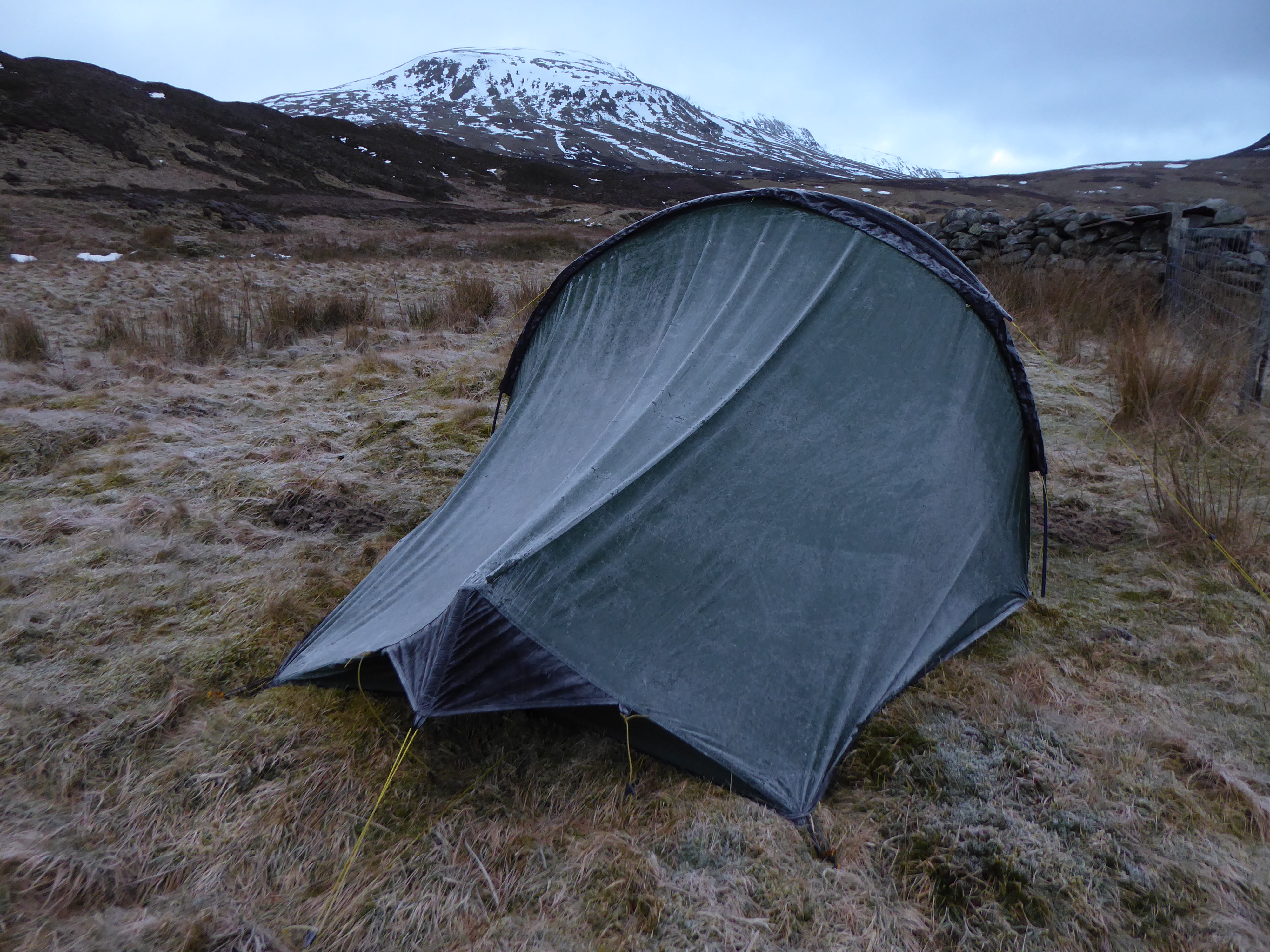
Once I had left Callander, I hadn't seen another person and that was the case the next morning as well as I walked through to Comrie. The night had left a fine dusting of frost on the tent and I lingered late until it dried off. Once on the move, I really enjoyed the day's journey. The track dropped down to the farm at the head of Glen Artney then picked up an old, rough path that headed towards Comrie on the north side of the river. It was a delightful route that switched between woods and open pastures, sometimes beside the river but often high above it. 

At Comrie I picked up the beautiful woodland path to the Deil's Cauldron waterfall. The snow melt may have made the walking routes boggy but it also filled the waterfall which was a thunderous presence in the gorge. A short road walk then took me to Invergeldie and from here I was climbing into the hills again on another old path that connects Glen Lednock with Loch Tay.

I wasn't going that far but still had to cross a high pass that was clogged with melting snow and hard going underfoot. The hills here now were streaked with snow and though the scenery was bleak, there was a peace and wildness out here, and I enjoyed having this to myself. The descent from the pass put me at the head of Glen Almond and a river crossing took me to an old, drystane sheep fank that provided the second camp spot of the trip. 

I can't really say exactly what it was but this was a wonderful camp spot. It was relatively remote but the old walls gave it a sense of place. Snow-covered hills rose above the tent and there was no sound except the rush of the river. Temperatures plummeted in the evening and my damp socks turned as stiff as cardboard. But the clear, crisp night created an inky sky full with stars and I lay for ages with my tent door open gazing up at them.

It was the last of the clear weather though. The next day I started walking down Glen Almond under ominous, grey skies. In keeping with this, the glen had a quiet, empty feel in its upper reaches and there was nobody around. But further down farm buildings and cottages appeared with dogs barking outside and people working away in outbuildings. I left the glen via a wonderful route that climbed up through Glen Lochan. The cloud had lowered further, obscuring the hills, and the path wound its way through a tight pass where you could have imagined a pterodactyl swooping through out of the mist. Before I descended to Loch Freuchie on the other side, the rain came on and would accompany me for the rest of the way to Aberfeldy.

The route from Loch Freuchie used the single track, summer hill road to Kenmore to the top of the pass before picking up a track to Urlar and on to Aberfeldy. The road is closed in winter so I'd no need to worry about dodging traffic though I don't think it's ever busy. As the road climbed into the hills, the now torrential rain turned to snow and I found myself grinning. I do love a tussle with the weather. Having said that, I was still glad when the turn off appeared out of the blizzard and I started the descent to Aberfeldy. It was late in the day though and the light was fading, so I spent another night out in the tent.


By morning, it had rained all night and was still raining, so the final part of the journey down through the Birks of Aberfeldy was accompanied by the roar of the swollen river. But it was satisfying to complete my journey and to have covered the miles on foot.

Fact File
Start: Callander
Finish: Aberfeldy
Public transport: Train to Stirling and bus from Stirling to Callander. Bus from Aberfeldy to Dunkeld then train back to Edinburgh.
My route: Took the hill road to the north out of Callander which is signed for Bracklin Falls. It becomes track at Braeleny and passes over to Glen Artney. At the head of Glen Artney passed through the farm buildings and walked the rough route on the north side of the river which eventually meets a quiet road into Comrie. Took the path signed for the Deil's Cauldron and then joined the road in Glen Lednock above the falls. At Invergeldie took the track heading northeast which is the route up Ben Chonzie but left it where another track branches off to the northwest. Descended to the Glen Almond and crossed the river. The bridge marked on the OS map is no longer there and the bridge just downstream was not one that I would cross! Down Glen Almond then through the farm buildings at Auchnafree to pick up the path through Glen Lochan. Where it meets the road at Loch Freuchie, turned left and walked up and over the hill road to Kenmore until reaching a loch with a hut on the shore. Took the track on the south shore of the loch and it eventually reaches Aberfeldy via the farm at Urlar.


Saturday, 19 March 2022

Glen Finglas - Contrasting days

With hindsight, it was a terrible place to pitch the tents but the grassy knoll had been the only dry oasis in miles of bog and heather. Plus the forecast had said the winds would be light but instead they hammered through like a freight train, creating a vortex around the knoll and bending my tent inwards in an alarming fashion. It was 5am in the hills above Brig o'Turk and I was wondering if the tents would remain standing, never mind if I'd be able to cook breakfast in the blasts. But then something magical happened.

I'd been aware when I woke up during the night of there not being full darkness so guessed a decent moon must be up behind the clouds. Then a little before dawn, the winds eased off and I unzipped the tent door to poke my head outside. A stunning sight greeted me. The tents were facing west with an open view from the knoll to the shapely twin peaks of Ben More and Stob Binnein. Above the peaks was an incredibly bright full moon that shone gold rather than silver. Behind it was the thinnest veil of cloud that picked up the golden light of the moon and silhouetted the two peaks. Over the next half hour or so, the moon sank such that it looked like it was rolling down the side of Stob Binnein to set perfectly placed in the bealach between it and Ben More. It was a spectacular moment and the terrible camp spot became the perfect grandstand from which to watch it. 

Those overnight winds had cleared the cloud and dense drizzle of the day before when we'd walked in from Brig o'Turk. It hadn't been at all unpleasant as it created a secret, other-worldly atmosphere and we saw not another soul. The colours were monotone and there had been barely a breath of wind to shake the water droplets from the birch branches. 

But this second day was a real contrast with brash, bright colours in the cobalt sky, the straw-coloured hillsides and the hi-viz mountain-bikers. Our camp spot had been at the highest point on the Glen Finglas loop so while yesterday's walk was all climbing, today's was mostly downhill. 

The low winter sun cast a gentle golden light over the day in the same way the moon had over the night. It encouraged us to linger at the river and brew a second morning coffee before completing the walk out.


Fact File

Start/finish: Brig o'Turk
Public transport: No regular buses to the start but you can use Stirling Council's Demand Responsive Transport service. Alternatively, if you have time, you could take the regular bus from Stirling to Callander and use the Great Trossachs Path to walk to Brig o'Turk.
My route: Took the quiet road that passes through Brig o'Turk and heads uphill. It eventually becomes a dirt track where the public road ends. Passed farm buildings and took the track to the right signed for Balquhidder. Stayed on the track to make a big loop behind Meall Cala and return alongside the Finglas Water which is now bridged where the track crosses it.