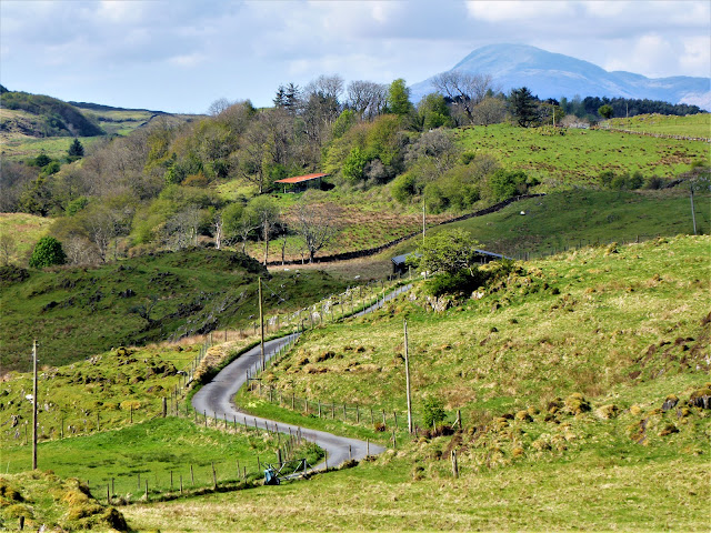
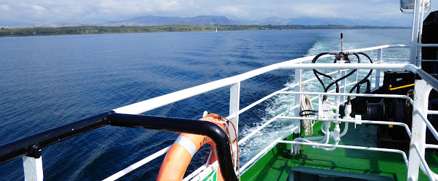
The latter part of my May holiday was a bit of an island fest because after Kerrera, I decided to head to Lismore for a couple of days. I was really enjoying being at the coast and sucking in the revitalising sea air. There's also an incredible richness to islands where the different sights and sounds of land and water meet. It's pure bliss. My second island was larger than Kerrera and a longer ferry journey from Oban at just under an hour. Lismore is mostly low lying and quite flat which, along with its detached position in Loch Linnhe, affords wonderful views of mountains all around. This changes the character of the island to something much more wild and rugged.
My mid afternoon ferry left Oban through a curtain of torrential rain which obscured the usually lovely views to Mull and the hills of Lochaber. Eventually Achnacroish, Lismore's ferry terminal, appeared through the gloom and the ferry docked. I walked up the road to the Lismore Bunkhouse which had been built on a renovated croft, now a wildlife haven. There are a few spots for tents but when I was offered a bunk room to myself with a view over the croft, I couldn't resist. The weather cleared later and from my room I could see north to Beinn a'Bheither and Ben Nevis. The couple who own the croft have planted over 7,000 trees here so the dawn and dusk bird song was beautiful. My evening entertainment was watching the rescue chickens who stomped haughtily around the croft pecking at the ground.
Lismore is a rare outcrop of limestone which is unusual in the geology of the west coast of Scotland. So in the 19th century, Sailean was a major industrial site where the limestone was quarried, burned in limekilns and shipped out for use as agricultural lime and building mortar. Extensive ruins remain today, including the limekiln itself, as well as the pier which is still in use. It's such an idyllic spot set on a quiet bay with nature slowly reclaiming the ruins.
Walking on from Sailean, I joined the main road along the island which is all single track and very quiet. The verges were full with primroses and orchids. This is due to the rich, alkaline soils created by the limestone and is why Lismore is also known as the The Great Garden.
My path passed in front of the pretty row of cottages at Achnacroish then headed up the east coast through fields and woods. I was aiming for Tirefour Broch which dominated the horizon ahead.
The broch dates from the late Iron Age and was built about 2000 years ago. The structure would have originally been five metres high and the walls three metres thick. It's believed it was inhabited until the Middle Ages. Among the finds in the broch are a decorative pin from the 8th century and Norse pins and rivets from the 11th or 12th centuries. What is most obvious about the broch is its commanding position above the sea and the east coast of the island. This made it a stunning place to sit a while, with panoramic views all round and an alarming drop to the sea.
It's thought that the broch fell into disuse when the seat of power shifted to the Clan MacDougall castles on the west coast of the island. I headed to one of them next.
A meandering farm road took me back to the main island road and I walked a little way south. Before too long, I passed the pretty parish church whose graveyard was awash with primroses and bluebells.
Just after here, I turned onto a rough farm track and descended steeply to the coast at an idyllic bay. Here were the ruins of Castle Coeffin.
The castle was built in the 13th century but it's thought the site was in use for much longer with an Iron Age fort located close by. Local tradition has always associated the castle with a legendary Norse prince called Caifean. The ghost of his sister Beothail was said to haunt the castle until he freed her by taking her bones back to Norway. At low tide, the sheltered bay below the castle reveals a medieval fish trap and boat haul out. It was yet another blissful spot to sit a while with views over a rocky coastline to the hills of Morvern.
From the castle, it was a few kilometres of walking under a hot sun to return to the bunkhouse via the island museum and cafe, and its little shop. I was lucky that the weather held for my return ferry journey the next morning and I could enjoy the views from the deck that I'd missed on the way out.


No comments:
Post a Comment