Sunday 27 January 2019

Lomond Hills - Raw

Raw is the word that describes that early January day in Fife’s Lomond Hills. Not just in terms of the weather. There was also something raw about the landscape laid out before us. 

On the coldest morning of the winter so far, my friend Graham and I ambled through the quaint, narrow streets of the ancient village of Falkland, passing its royal palace and rows of pretty cottages. Beyond the village, we turned up the beautiful gorge of Maspie Den. If it had been cold in the village, then it was absolutely raw here where the cold air had sunk and settled in the den’s narrow confines. The stream through the gorge was frozen at its edges but mostly continued to flow, babbling gently under the many bridges that criss-crossed its course. At the head of the glen, we passed behind the stream’s waterfall and the long icicles overhanging the lip. 


Beyond Maspie Den our path climbed up onto the bealach between the peaks of West and East Lomond, the two most prominent tops in the Lomond Hills.  In climbing up we left the lower freezing air and reached the weak, winter sunshine that bathed the land in rich morning light. Finally, gloves could be removed without instant numbness. We made the long walk out to West Lomond which was gradual at first but finished with a short, steep finale onto the top. 

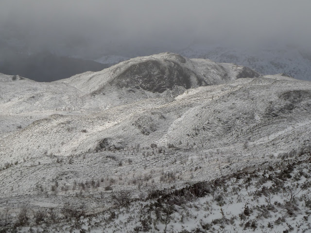
From West Lomond, I looked over to East Lomond and the long escarpment on which both peaks sit. The view was perfect on such a clear, crisp day. Much like the last walk to Binny Craig, the landscape appeared to me so raw and elemental. I could really see the nature of the land, its character and formation. The Lomond Hills are volcanic in origin. It seemed easy that day to appreciate their turbulent past in the ruggedness of the escarpment which was a massive, rocky, lumpy upswelling rising suddenly and incongruously from the genteel patchwork of the farmland surrounding it. 


Despite the sunshine, it was still too cold to linger on the top, so we set out on the long walk to East Lomond at the other end of the escarpment. Having lived in Fife for a number of years, I’ve walked in the Lomond Hills many times but it was Graham’s first visit. He was quite amazed at how far apart the two peaks were because, like me these days, he is used the distant view of the hills across the Firth of Forth from Portobello. They don’t look too far apart from Porty! But the long walk eventually put us on the top of East Lomond. 

After a flurry of photos, we dropped off the hill’s steep north side to head back down into Falkland and back down into the cold, raw air of the morning. 

Fact File
All the photos on Flickr - click HERE
Start/finish: Falkland, Fife
Public transport: For the January trip used Graham's car because of the short winter days but when I did this walk previously I used the train from Edinburgh to Markinch then cycled to the start at Falkland, about 10 miles along nice, quiet back roads.
My route: From the fountain in the centre of Falkland continued walking west along the main street which eventually left the village then passed through the gates of Falkland Estate. Shortly after, the path up Maspie Den is signed to the left. At the top of the path, passed behind the waterfall and when the den path meets another path, turned left and continued uphill. This path reaches the bealach between East and West Lomond. For West Lomond, after the gate and drystone wall took the wide grassy path to the right which is an obvious route to the top of West Lomond. Returned to the bealach, crossed the wee road that passes between the hills and picked up the obvious track on the other side along the north edge of the trees to East Lomond. From the top of East Lomond took the path that heads steeply northeast down the hill into the forest and eventually pops out in Falkland.

Sunday 13 January 2019

West Lothian - Where have you Binny all my life?

You can’t say this blog doesn’t take you to some exotic locations! This time we are in West Lothian! A couple of cycle rides aside, I’ve not spent much of my life exploring West Lothian despite the fact that it’s right on my doorstep. I suppose I’ve assumed that it’s just farmland and dreary towns. But my view has changed. Over the festive season I had a fabulous walk in West Lothian up a fascinating little hill called Binny Craig.

Situated a mile north of Uphall and pointing its rocky prow above the surrounding farmland, Binny Craig is only 219 metres high but a striking landscape feature. It’s a “crag and tail” landform which means it has a crag of hard rock facing west and a sloping tail of sedimentary rock running down to farmland to the east. The sedimentary rock was formed when this area was under the sea hundreds of millions of years ago. Over time, the land rose and during the last Ice Age glaciers moved in from the west, grinding away the softer sedimentary rocks to leave the harder exposed rock and creating Binny Craig as we see it today.


There was a hint of the last Ice Age that morning as my friend Graham and I cycled away from Uphall Station. The day was still and grey, gripped in cold and slick with ice in places. Our cycle route popped out on the far side of Uphall and there ahead of us was Binny Craig. It’s really quite a bizarre sight, rising suddenly from the farmland all around. 


Back roads took us to the bottom of the hill and a footpath crossed the fields before climbing sharply up through mossy winter woods. At the top of the trees we were at the bottom of the final steep section of the hill. And steep it was as we picked our way up Binny Craig’s tail to the top. The crags fell away to our west, dropping sheer to bare birch woods below. To the north, a narrow band of sunshine caught the Ochil Hills, their russet slopes the only colour on offer. And as I looked around, I started to see other little hills rise gently above low-lying mist and patches of old woodland. It was really quite nice.

So I’m sorry West Lothian that I’ve ignored you all my life but now I've found you, I'll definitely be back.

Fact File
Start/finish: Uphall Train Station
Public transport: Train from Edinburgh to Uphall
My route: Off the train turned left in the car park and picked up a cycle path at the far end signed for Uphall. On reaching the main street in Uphall turned right then left up Ecclesmachan Road. Took the next unclassified road to the left and just over 1.5km along it the footpath up Binny Craig is signed. We walked up and back down the same way but explored also a little the surrounding woods. On the way back, before Uphall we picked up a footpath signed for the village on our right and this popped out on the main street opposite the start of the cycle path back to the train station. There was also a footpath signed for Uphall just before the hill path for Binny Craig and that might provide a nicer link between the hill and the train station than the road.

Sunday 6 January 2019

Trossachs - Foxy

I'm a real early morning person. On work days I’m up at five and leave the house at six to cycle to work from the east side of the city to the west side. I like the quietness of early morning and on my ride to work I often see wildlife that doesn’t show itself later in the day. I have seen deer by the river, otters in the local pond and even a badger one morning on the cycle path. But my most common mammalian encounter in the city is with urban foxes. I’m always thrilled to see them with their pretty, delicate faces and their Irn-Bru coloured coats. I marvel at their ability to adapt to life in the city alongside man. However, it’s much less often that I see foxes when out in the hills and countryside. Perhaps here they are more wary and secretive due to years of persecution. But I was reminded recently that although they may not be visible, they are certainly out there!

When the December snowfall came, I was out for a long, rambling meander in the Trossachs. Essentially a circuit of Loch Vennachar from Callander with pleasing detours. Before the snow the weather was grey with a low ceiling of cloud and so little light that it was difficult to tell when the day ended and the night began. In late afternoon after a walk to Loch Drunkie during which I saw not another soul, I pitched the tent in the trees on the shore of Loch Vennachar. The rain that had fallen unremittingly during the afternoon turned to hail in the evening and then snow during the night. I knew this before I got up in the morning as, lying cosy in my sleeping bag, I could hear wet, heavy snow slide down the sides of my tent.  

As I set out along the trail, I enjoyed a world transformed by the snow into something wilder and prettier. But what I enjoyed most of all was walking with the foxes! That’s to say we walked the same trails, just hours apart from each other. It seemed that on every path I took that day there were fox prints in the snow, parallel to my own. And sometimes there were two sets of prints from different foxes whose paths also crossed at different hours.  Onwards I walked passed Brig o’Turk, through the woods of Glen Finglas and along the Great Trossachs Path above the loch and fields. All the way my route was criss-crossed by foxy tracks.  


Fact File
Start/finish: Callander
Public transport: Train to Stirling, bus to Callander.
My route: Followed national cycle route 7 south out of Callander along the south shore of Loch Vennachar and onto Loch Drunkie. Back to Loch Vennacher to camp then continued west on south shore track, taking eventually right turn on track signed for Brig o’Turk. Followed Great Trossachs Path back to Callander through Brig o’Turk and Glen Finglas woods then east in the fields and hills above the north shore of Loch Vennacher.